Plik:Asker Line map.jpg
Rozmiar podglądu – 800 × 512 pikseli. Inne rozdzielczości: 320 × 205 pikseli | 640 × 410 pikseli | 898 × 575 pikseli.
Rozmiar pierwotny (898 × 575 pikseli, rozmiar pliku: 129 KB, typ MIME: image/jpeg)
| Plik Asker Line map.jpg znajduje się w Wikimedia Commons – repozytorium wolnych zasobów. Dane z jego strony opisu znajdują się poniżej. |
| Opis |
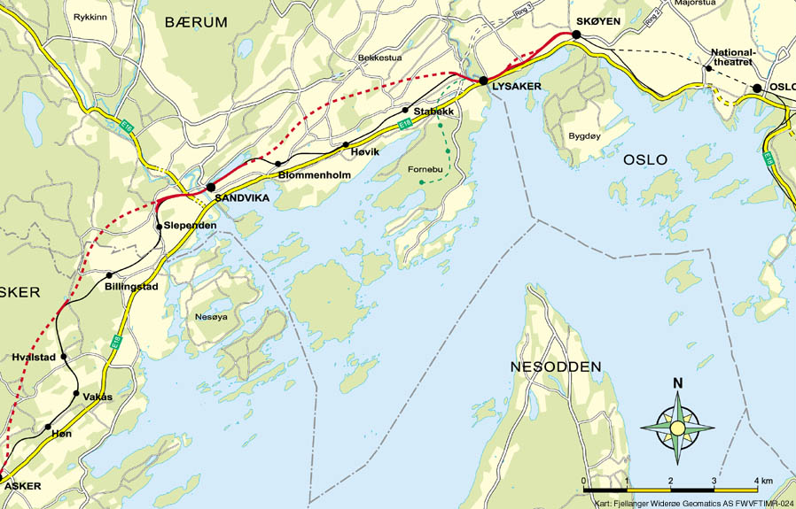
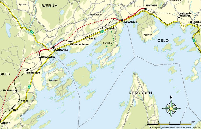
English: Map of the Asker Line west of Oslo, Norway. Red line is the Asker Line and black line is the Drammen Line. Dotted lines are tunnels. Black dots are stations. The green line is the Fornebu Line. The yellow lines indicate European Routes E16 and E18. |
|||
| Źródło | http://www.jernbaneverket.no/multimedia/archive/01417/Kart_Sk_yen-Asker_1417793a.jpg | |||
| Autor | Jernbaneverket / Norwegian National Rail Administration | |||
| Licencja (Ponowne użycie tego pliku) |
|


|
Ta grafika (map) (lub wszystkie grafiki w tym artykule bądź kategorii) powinny zostać przetworzone na grafiki wektorowe jako plik SVG. O zaletach grafik wektorowych można przeczytać na stronie Commons:Media for cleanup. Jeśli wersja SVG tej grafiki jest już dostępna, załaduj ją. Po załadowaniu SVG zamień ten szablon na stronie tej grafiki na szablon {{vector version available|nazwa nowej grafiki.svg}}.
|


Historia pliku
Kliknij na datę/czas, aby zobaczyć, jak plik wyglądał w tym czasie.
| Data i czas | Miniatura | Wymiary | Użytkownik | Opis | |
|---|---|---|---|---|---|
| aktualny | 12:56, 7 maj 2020 | | 898 × 575 (129 KB) | Tholme | Cropped 3 % horizontally, 5 % vertically using CropTool with lossless mode. Remove border |
| 20:58, 18 lis 2008 |  | 926 × 603 (136 KB) | Arsenikk | {{Information |Description={{en|1=Map of the Asker Line west of Oslo, Norway. Red line is the Asker Line and black line is the Drammen Line. Dotted lines are tunnels. Black dots are stati |
Lokalne wykorzystanie pliku
Poniższa strona korzysta z tego pliku:
Globalne wykorzystanie pliku
Ten plik jest wykorzystywany także w innych projektach wiki:
- Wykorzystanie na da.wikipedia.org
- Wykorzystanie na de.wikipedia.org
- Wykorzystanie na en.wikipedia.org
- Wykorzystanie na fr.wikipedia.org
- Wykorzystanie na id.wikipedia.org
- Wykorzystanie na nl.wikipedia.org
- Wykorzystanie na nn.wikipedia.org
- Wykorzystanie na no.wikipedia.org
- Wykorzystanie na sv.wikipedia.org
- Wykorzystanie na www.wikidata.org