Plik:EF1 damage Richardson, Texas.jpg

Rozmiar podglądu – 800 × 534 pikseli. Inne rozdzielczości: 320 × 213 pikseli | 640 × 427 pikseli | 964 × 643 pikseli.
Rozmiar pierwotny (964 × 643 pikseli, rozmiar pliku: 574 KB, typ MIME: image/jpeg)
| Plik EF1 damage Richardson, Texas.jpg znajduje się w Wikimedia Commons – repozytorium wolnych zasobów. Dane z jego strony opisu znajdują się poniżej. |
Opis
| Opis |
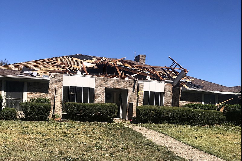
English: Example of EF1 tornado damage. This house in Richardson, Texas lost a large section of its roof surface to a tornado. The image has been cropped to focus on the damaged house. |
| Data | |
| Źródło | https://services.dat.noaa.gov/arcgis/rest/services/nws_damageassessmenttoolkit/DamageViewer/MapServer/0/1987364/attachments/1238623 |
| Autor | National Weather Service Forecast Office in Dallas/Fort Worth, Texas |
Licencja
This image is in the public domain because it was stored on the web servers of the U.S. National Oceanic and Atmospheric Administration, specifically on the Damage Assessment Toolkit (DAT), an interactive map and database. Images on the Damage Assessment Toolkit are taken by the 122 National Weather Service forecast offices as well as the National Severe Storms Laboratory.
Thus, all images on the Damage Assessment Toolkit are public domain.
|
Historia pliku
Kliknij na datę/czas, aby zobaczyć, jak plik wyglądał w tym czasie.
| Data i czas | Miniatura | Wymiary | Użytkownik | Opis | |
|---|---|---|---|---|---|
| aktualny | 04:46, 3 gru 2019 | | 964 × 643 (574 KB) | TornadoLGS | User created page with UploadWizard |
Lokalne wykorzystanie pliku
Poniższa strona korzysta z tego pliku:
Globalne wykorzystanie pliku
Ten plik jest wykorzystywany także w innych projektach wiki:
- Wykorzystanie na en.wikipedia.org
- Wykorzystanie na fr.wikipedia.org
- Wykorzystanie na simple.wikipedia.org
- Wykorzystanie na th.wikipedia.org