Plik:Kanawha Ohio confluence.jpg

Rozmiar podglądu – 751 × 600 pikseli. Inne rozdzielczości: 301 × 240 pikseli | 601 × 480 pikseli | 962 × 768 pikseli | 1280 × 1022 pikseli | 1500 × 1198 pikseli.
Rozmiar pierwotny (1500 × 1198 pikseli, rozmiar pliku: 724 KB, typ MIME: image/jpeg)
| Plik Kanawha Ohio confluence.jpg znajduje się w Wikimedia Commons – repozytorium wolnych zasobów. Dane z jego strony opisu znajdują się poniżej. |
Opis
| Opis |
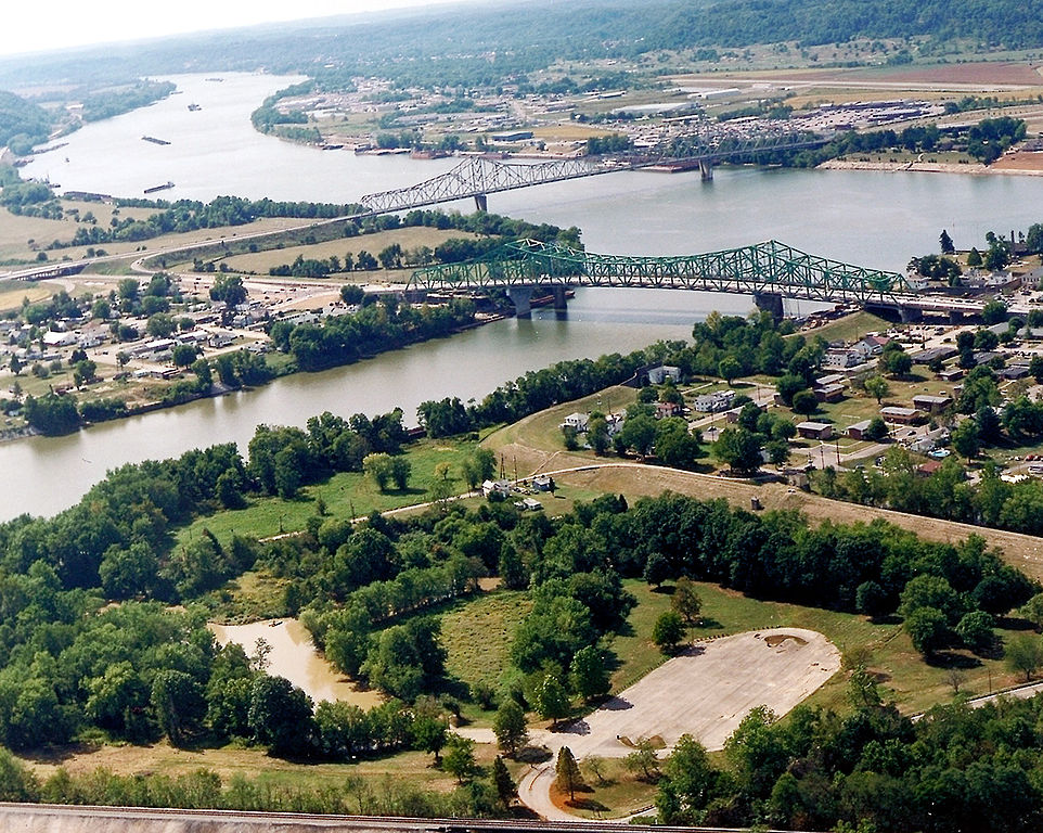
English: The confluence of the Kanawha and Ohio Rivers. The Kanawha River flows in from the left of the picture and joins the Ohio, meandering off in the distance. The town of Point Pleasant, West Virginia is in the foreground on the right. Henderson, West Virginia is on the left. The Ohio River forms the boundary between West Virginia and Ohio. The town of Gallipolis, Ohio lies in the far distance across the Ohio River. The view is to the west-southwest down the river. |
|||
| Data | przed 2007 | |||
| Źródło |
U.S. Army Corps of Engineers Digital Visual Library Image page Image description page Digital Visual Library home page |
|||
| Autor | Charles Johnson, U.S. Army Corps of Engineers | |||
| Licencja (Ponowne użycie tego pliku) |
|
|||
| Miejsce | Point Pleasant, West Virginia, USA |
| Pozycja fotografa | | To i inne zdjęcia na: OpenStreetMap |
|---|
| Adnotacje | To zdjęcie jest opatrzone adnotacją: Zobacz adnotacje w Commons |
Historia pliku
Kliknij na datę/czas, aby zobaczyć, jak plik wyglądał w tym czasie.
| Data i czas | Miniatura | Wymiary | Użytkownik | Opis | |
|---|---|---|---|---|---|
| aktualny | 06:52, 23 mar 2007 | | 1500 × 1198 (724 KB) | DanMS | {{Information | Description = {{en|The confluence of the Kanawha and Ohio Rivers. The Kanawha River flows in from the left of the picture and joins the Ohio, meandering off in the distance. The town of Point Pleasant, West Virginia is in the foreground |
Lokalne wykorzystanie pliku
Następujące strony korzystają z tego pliku:
Globalne wykorzystanie pliku
Ten plik jest wykorzystywany także w innych projektach wiki:
- Wykorzystanie na ar.wikipedia.org
- Wykorzystanie na arz.wikipedia.org
- Wykorzystanie na ca.wikipedia.org
- Wykorzystanie na ceb.wikipedia.org
- Wykorzystanie na ce.wikipedia.org
- Wykorzystanie na cy.wikipedia.org
- Wykorzystanie na dag.wikipedia.org
- Wykorzystanie na de.wikipedia.org
- Wykorzystanie na en.wikipedia.org
- Wykorzystanie na en.wikivoyage.org
- Wykorzystanie na es.wikipedia.org
- Wykorzystanie na eu.wikipedia.org
- Wykorzystanie na fa.wikipedia.org
- Wykorzystanie na fr.wikipedia.org
- Wykorzystanie na hu.wikipedia.org
- Wykorzystanie na it.wikipedia.org
- Wykorzystanie na ja.wikipedia.org
- Wykorzystanie na ko.wikipedia.org
- Wykorzystanie na kw.wikipedia.org
- Wykorzystanie na lld.wikipedia.org
- Wykorzystanie na no.wikipedia.org
- Wykorzystanie na pt.wikipedia.org
- Wykorzystanie na ro.wikipedia.org
- Wykorzystanie na ru.wikipedia.org
- Wykorzystanie na sh.wikipedia.org
- Wykorzystanie na simple.wikipedia.org
- Wykorzystanie na sr.wikipedia.org
- Wykorzystanie na tt.wikipedia.org
- Wykorzystanie na uk.wikipedia.org
Pokaż listę globalnego wykorzystania tego pliku.