Plik:MINURSO Deployment (April 2014).png
Rozmiar pierwotny (2278 × 2779 pikseli, rozmiar pliku: 973 KB, typ MIME: image/png)
| Plik MINURSO Deployment (April 2014).png znajduje się w Wikimedia Commons – repozytorium wolnych zasobów. Dane z jego strony opisu znajdują się poniżej. |

|
Ta grafika (map) (lub wszystkie grafiki w tym artykule bądź kategorii) powinny zostać przetworzone na grafiki wektorowe jako plik SVG. O zaletach grafik wektorowych można przeczytać na stronie Commons:Media for cleanup. Jeśli wersja SVG tej grafiki jest już dostępna, załaduj ją. Po załadowaniu SVG zamień ten szablon na stronie tej grafiki na szablon {{vector version available|nazwa nowej grafiki.svg}}.
|
Opis
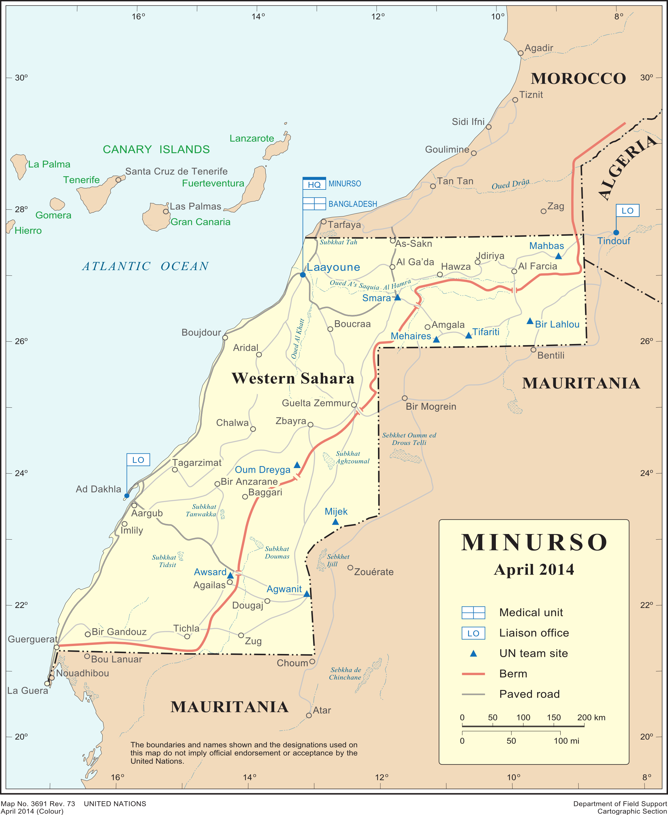
| Opis |
English: Deployment of MINURSO, as of April 2014
Français : Déploiement de la Minurso au Sahara occidental |
| Data | |
| Źródło | [1], which had not been changed as of Sept 2019 |
| Autor | United Nations Cartographic Section |
| Inne wersje |
|

.png)
Licencja
| This image is a map derived from a United Nations map.
Unless stated otherwise, UN maps are to be considered in the public domain. This applies worldwide. UN maps are, in principle, open source material and you can use them in your work or for making your own map. UN requests however that you delete the UN name, logo and reference number upon any modification to the map. Content of your map will be your responsibility. You can state in your publication, if you wish, something like: based on UN map … (map name, map number, revision number and date). See: Geospatial Information Section. And: Geospatial, location data for a better world. |
 |
Historia pliku
Kliknij na datę/czas, aby zobaczyć, jak plik wyglądał w tym czasie.
| Data i czas | Miniatura | Wymiary | Użytkownik | Opis | |
|---|---|---|---|---|---|
| aktualny | 13:29, 17 kwi 2015 | | 2278 × 2779 (973 KB) | Treehill | User created page with UploadWizard |
Lokalne wykorzystanie pliku
Poniższa strona korzysta z tego pliku:
Globalne wykorzystanie pliku
Ten plik jest wykorzystywany także w innych projektach wiki:
- Wykorzystanie na ar.wikipedia.org
- Wykorzystanie na ca.wikipedia.org
- Wykorzystanie na el.wikipedia.org
- Wykorzystanie na en.wikipedia.org
- Wykorzystanie na fr.wikipedia.org
- Wykorzystanie na ja.wikipedia.org
- Wykorzystanie na nl.wikipedia.org
- Wykorzystanie na ru.wikipedia.org
- Wykorzystanie na www.wikidata.org
.png)