Plik:Bradgate park general map.png
Grafika w wyższej rozdzielczości nie jest dostępna.
Bradgate_park_general_map.png (653 × 442 pikseli, rozmiar pliku: 350 KB, typ MIME: image/png)
| Plik Bradgate park general map.png znajduje się w Wikimedia Commons – repozytorium wolnych zasobów. Dane z jego strony opisu znajdują się poniżej. |
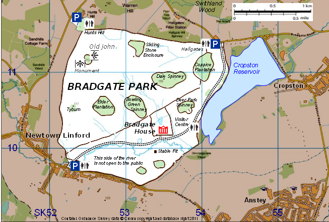
Opis
| Opis |
English: Map of Bradgate Park, Leicestershire, England, showing its main topographical features |
| Data | |
| Źródło | created by Robin Stevenson based on Ordnance Survey data © Crown copyright and database right 2011 available under OS Opendata, from OS Vectormap District raster map SK51, downloadable from https://www.ordnancesurvey.co.uk/opendatadownload/products.html |
| Autor | Robin Stevenson based on Ordnance Survey data © Crown copyright and database right 2011 under UK Open Government licence at http://www.nationalarchives.gov.uk/doc/open-government-licence/open-government-licence.htm |
Licencja
This file is licensed by the Ordnance Survey of the United Kingdom under their OS OpenData License
In short: you are free to distribute and modify the file as long as you attribute (including year), the Ordnance Survey. Uznanie autorstwa: Contains Ordnance Survey data © Crown copyright and database right (year) Note: Derivative works can be licensed under any Creative Commons Attribution 3.0 Licence. |
.svg)
|
This file is licensed under the United Kingdom Open Government Licence v3.0. |
See also: Meta for information on usage on Wikimedia wikis.
|
Historia pliku
Kliknij na datę/czas, aby zobaczyć, jak plik wyglądał w tym czasie.
| Data i czas | Miniatura | Wymiary | Użytkownik | Opis | |
|---|---|---|---|---|---|
| aktualny | 20:02, 27 sty 2011 | | 653 × 442 (350 KB) | RobinLeicester | {{Information |Description ={{en|1=Map of Bradgate Park, Leicestershire, England, showing its main topographical features}} |Source =created by Robin Stevenson based on Ordnance Survey data © Crown copyright and database right 2011 available u |
Lokalne wykorzystanie pliku
Poniższa strona korzysta z tego pliku:
Globalne wykorzystanie pliku
Ten plik jest wykorzystywany także w innych projektach wiki:
- Wykorzystanie na ar.wikipedia.org
- Wykorzystanie na en.wikipedia.org
- Wykorzystanie na zh.wikipedia.org