Plik:Europe mediterranean 1097.jpg

Rozmiar pierwotny (2270 × 1789 pikseli, rozmiar pliku: 4,85 MB, typ MIME: image/jpeg)
| Plik Europe mediterranean 1097.jpg znajduje się w Wikimedia Commons – repozytorium wolnych zasobów. Dane z jego strony opisu znajdują się poniżej. |


|
This map has been uploaded by Electionworld from en.wikipedia.org to enable the |
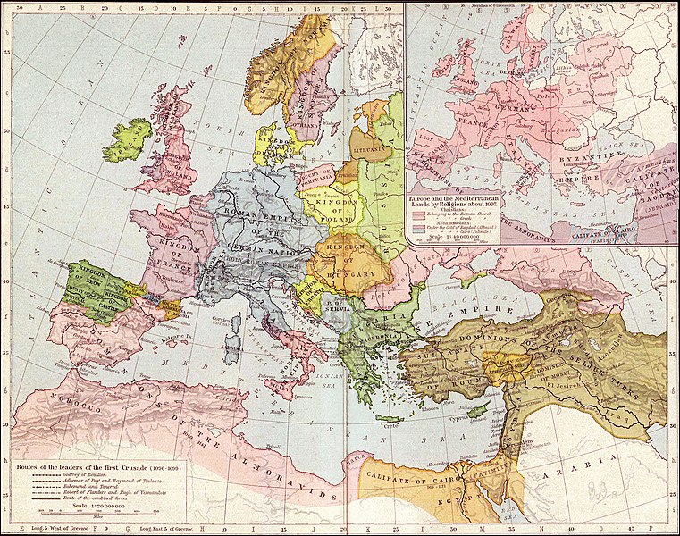
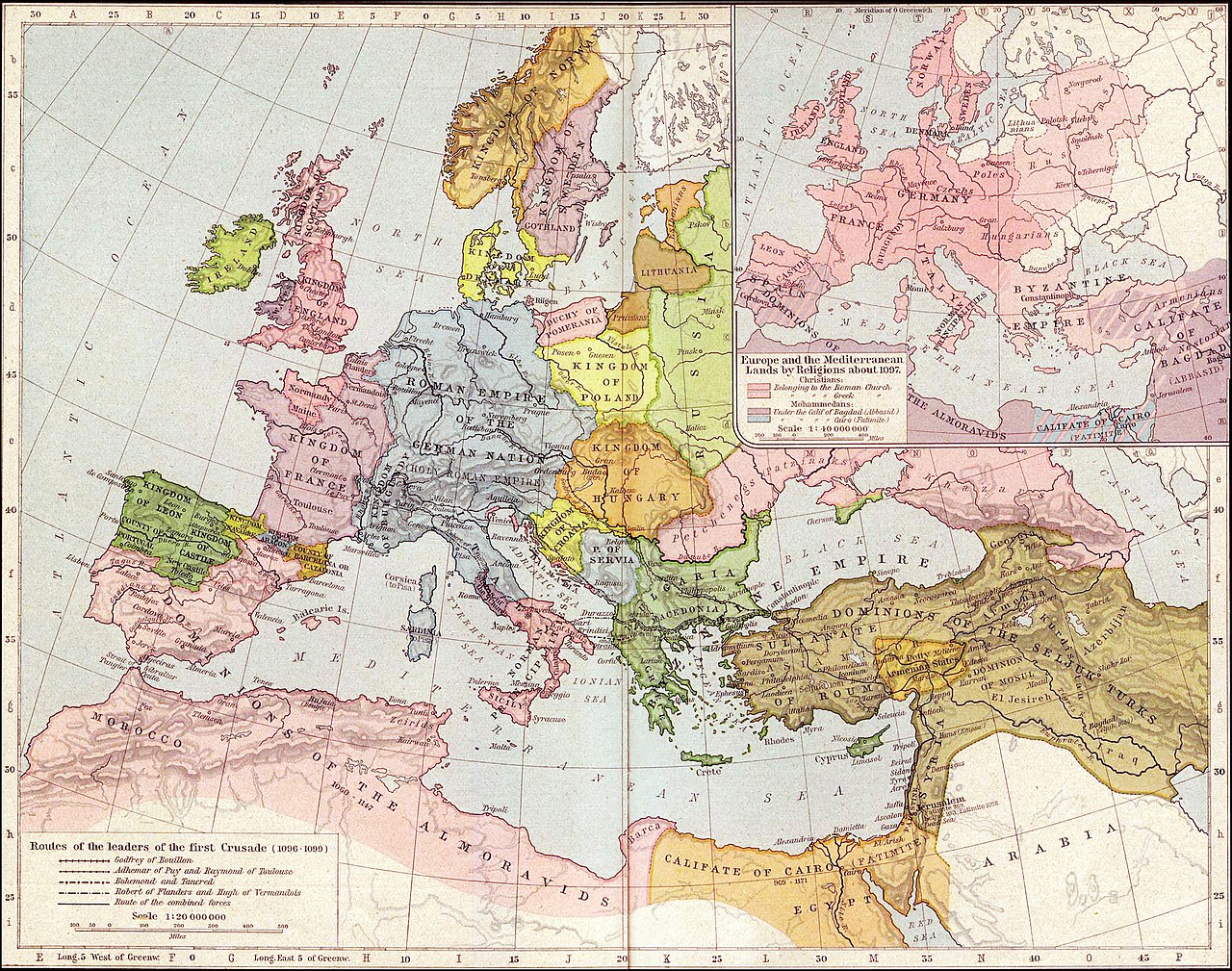
Map of Mediterranean and European lands anout 1097. Map from: Historical Atlas by William Shepherd (1923-26), in Public Domain
|
Ten materiał przeszedł do domeny publicznej w kraju pochodzenia, jak również w państwach i terytoriach, gdzie prawo autorskie wygasa w ciągu 70 lat po śmierci autora.
| |
| Plik rozpoznano jako wolny od znanych ograniczeń praw autorskich, włącznie z prawami zależnymi i pokrewnymi. | |
.jpg)
Historia pliku
Kliknij na datę/czas, aby zobaczyć, jak plik wyglądał w tym czasie.
| Data i czas | Miniatura | Wymiary | Użytkownik | Opis | |
|---|---|---|---|---|---|
| aktualny | 05:36, 27 wrz 2021 | | 2270 × 1789 (4,85 MB) | GPinkerton | Reverted to version as of 01:31, 30 January 2007 (UTC) do not alter historical maps! |
| 20:03, 26 cze 2020 |  | 2270 × 1789 (4,84 MB) | Claude Zygiel | Map of Europe and Mediterranean lands about 1097: Byzantine Empire had not been completely excluded from Anatolia (Mantzikert, 1071) and the lower Danube was not pagan even if Pechenegs were Tengrists. | |
| 03:31, 30 sty 2007 |  | 2270 × 1789 (4,85 MB) | Patrickneil | {{ew|en|Wirya}} Map of Kurdistan and Mediterranean and European lands anout 1097. Map from: [http://www.lib.utexas.edu/maps/historical/shepherd/europe_mediterranean_1097.jpg], in Public Domain {{PD-old}} | |
| 16:59, 3 gru 2006 |  | 2314 × 1805 (725 KB) | Electionworld | {{ew|en|Wirya}} Map of Kurdistan and Mediterranean and European lands anout 1097. Map from: [http://www.lib.utexas.edu/maps/historical/shepherd/europe_mediterranean_1097.jpg], in Public Domain {{PD}} |
Lokalne wykorzystanie pliku
Żadna strona nie korzysta z tego pliku.
Globalne wykorzystanie pliku
Ten plik jest wykorzystywany także w innych projektach wiki:
- Wykorzystanie na ast.wikipedia.org
- Wykorzystanie na ba.wikipedia.org
- Wykorzystanie na bg.wikipedia.org
- Wykorzystanie na ce.wikipedia.org
- Wykorzystanie na ckb.wikipedia.org
- Wykorzystanie na de.wikipedia.org
- Wykorzystanie na el.wikipedia.org
- Wykorzystanie na en.wikipedia.org
- Wykorzystanie na es.wikipedia.org
- Wykorzystanie na et.wikipedia.org
- Wykorzystanie na fa.wikipedia.org
- Wykorzystanie na fr.wikipedia.org
- Wykorzystanie na gl.wikipedia.org
- Wykorzystanie na hu.wikipedia.org
- Wykorzystanie na id.wikipedia.org
- Wykorzystanie na it.wikipedia.org
- Wykorzystanie na ms.wikipedia.org
- Wykorzystanie na nn.wikipedia.org
- Wykorzystanie na pnb.wikipedia.org
- Wykorzystanie na pt.wikipedia.org
- Wykorzystanie na ro.wikipedia.org
- Wykorzystanie na ru.wikipedia.org
Pokaż listę globalnego wykorzystania tego pliku.