Plik:Shengtian Pavillion.jpg

Rozmiar pierwotny (2048 × 1480 pikseli, rozmiar pliku: 3,04 MB, typ MIME: image/jpeg)
| Plik Shengtian Pavillion.jpg znajduje się w Wikimedia Commons – repozytorium wolnych zasobów. Dane z jego strony opisu znajdują się poniżej. |
Opis
| Opis |
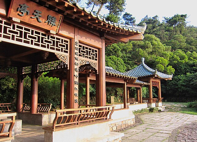
English: Place: Nangan, Matsu Islands
The Matsu islands are a minor archipelago of 36 islands and islets in the East China Sea and administered by the Republic of China (Taiwan). The Matsu islands together form the county of Lienchiang, but most of Liangjiang County (same name, different spelling) is under control of the People's Republic of China. Linear distance from mainland China is less than 20 km. Mainlanders from Fujian and Zhejiang started migrating to the islands during the Yuan Dynasty. The popular net fishing industry had established the base for development of Fuao settlement and industrial development of the region over several hundred years. During the early Qing Dynasty, pirates gathered here and the residents left temporarily. In contrast with Taiwan and Penghu, the Matsu Islands were not ceded to the Japanese Empire via the Treaty of Shimonoseki in 1895. Neither were they occupied by Japanese troops during World War II because they were not important militarily. Due to its strategic location for the only route for spice road, the British established the Dongyong Lighthouse in Dongyin Island in 1912 to facilitate ships navigation. In 1911, the Qing Dynasty was toppled after the Xinhai Revolution on 10 October 1911 and the Republic of China (ROC) was established on 1 January 1912. Matsu Islands was subsequently governed under the administration of Fukien Province of the ROC. On 1 August 1927, the Nanchang Uprising broke out between the ruling Nationalist Party of China (KMT) and Communist Party of China (CPC) which marked the beginning of Chinese Civil War. After years of war, the CPC finally managed to take over mainland China from KMT and established the People's Republic of China (PRC) on 1 October 1949 which also covers the Lianjiang County of Fujian. The KMT subsequently retreated from mainland China to Taiwan in end of 1949. After their retreat, the KMT retained the offshore part from the original Lianjiang County located on Matsu Islands, and also all of Kinmen County. In July 1958 the PRC began massing forces opposite the two islands and began bombarding them on 23 August, triggering the Second Taiwan Strait Crisis. On 4 September 1958, the PRC announced the extension of its territorial waters by 20 kilometres (12 mi) to include the two islands. However, after talks were held between the USA and PRC in Warsaw, Poland later that month, a ceasefire was agreed and the status quo reaffirmed. The phrase "Quemoy and Matsu" became part of American political language in the 1960 U.S. presidential election. During the debates, both candidates, Vice-President Richard Nixon and Senator John F. Kennedy, pledged to use American forces if necessary to protect Taiwan from invasion by the PRC, which the United States did not recognize as a legitimate government. But the two candidates had different opinions about whether to use American forces to protect Taiwan's forward positions, Quemoy and Matsu, also. In fact, Senator Kennedy stated that these islands - as little as 9 kilometres (5.5 mi) off the coast of China and as much as 170 kilometres (106 mi) from Taiwan - were strategically indefensible and were not essential to the defense of Taiwan. On the contrary, Vice-President Nixon maintained that since Quemoy and Matsu were in the "area of freedom," they should not be surrendered to the Communists as a matter of "principle." Self governance of the county resumed in 1992 after the normalization of the political warfare with the mainland and the abolishment of Battle Field Administration on 7 November 1992. Afterwards, the local constructions progressed tremendously. In 1999, the islands were designated under Matsu National Scenic Area Administration. In January 2001, direct cargo and passenger shipping started between Matsu and Fujian Province of the PRC. Since 1 January 2015, tourists from mainland China could directly apply the Exit and Entry Permit upon arrival in Matsu Islands. This privilege also applies to Penghu and Kinmen as means to boost tourism in the outlying islands of Taiwan. Source: en.wikipedia.org/wiki/Matsu_Islands In 2013 I had the opportunity to visit the largest of the Matsu islands, Nangan, as a friend of mine is a teacher at a primary school on the island. |
| Data | |
| Źródło | https://www.flickr.com/photos/rutgervandermaar/47481422612/ |
| Autor | Rutger van der Maar |
Licencja
- Wolno:
- dzielić się – kopiować, rozpowszechniać, odtwarzać i wykonywać utwór
- modyfikować – tworzyć utwory zależne
- Na następujących warunkach:
- uznanie autorstwa – musisz określić autorstwo utworu, podać link do licencji, a także wskazać czy utwór został zmieniony. Możesz to zrobić w każdy rozsądny sposób, o ile nie będzie to sugerować, że licencjodawca popiera Ciebie lub Twoje użycie utworu.
| Ten plik, opublikowany pierwotnie w serwisie Flickr przez Rutger van der Maar pod adresem https://flickr.com/photos/83468718@N06/47481422612, został sprawdzony 29 stycznia 2022 przez FlickreviewR 2, który potwierdził, że jest on tam dostępny na licencji cc-by-2.0. |
Historia pliku
Kliknij na datę/czas, aby zobaczyć, jak plik wyglądał w tym czasie.
| Data i czas | Miniatura | Wymiary | Użytkownik | Opis | |
|---|---|---|---|---|---|
| aktualny | 17:49, 29 sty 2022 | | 2048 × 1480 (3,04 MB) | DestinationFearFan | Uploaded a work by Rutger van der Maar from https://www.flickr.com/photos/rutgervandermaar/47481422612/ with UploadWizard |
Lokalne wykorzystanie pliku
Poniższa strona korzysta z tego pliku:
Globalne wykorzystanie pliku
Ten plik jest wykorzystywany także w innych projektach wiki:
- Wykorzystanie na ceb.wikipedia.org
- Wykorzystanie na eo.wikipedia.org
- Wykorzystanie na es.wikipedia.org
- Wykorzystanie na fr.wikipedia.org
- Wykorzystanie na mt.wikipedia.org
- Wykorzystanie na ru.wikipedia.org
- Wykorzystanie na vi.wikipedia.org
- Wykorzystanie na www.wikidata.org