Plik:Země Koruny české.jpg
Rozmiar pierwotny (2847 × 2260 pikseli, rozmiar pliku: 1,11 MB, typ MIME: image/jpeg)
| Plik Země Koruny české.jpg znajduje się w Wikimedia Commons – repozytorium wolnych zasobów. Dane z jego strony opisu znajdują się poniżej. |
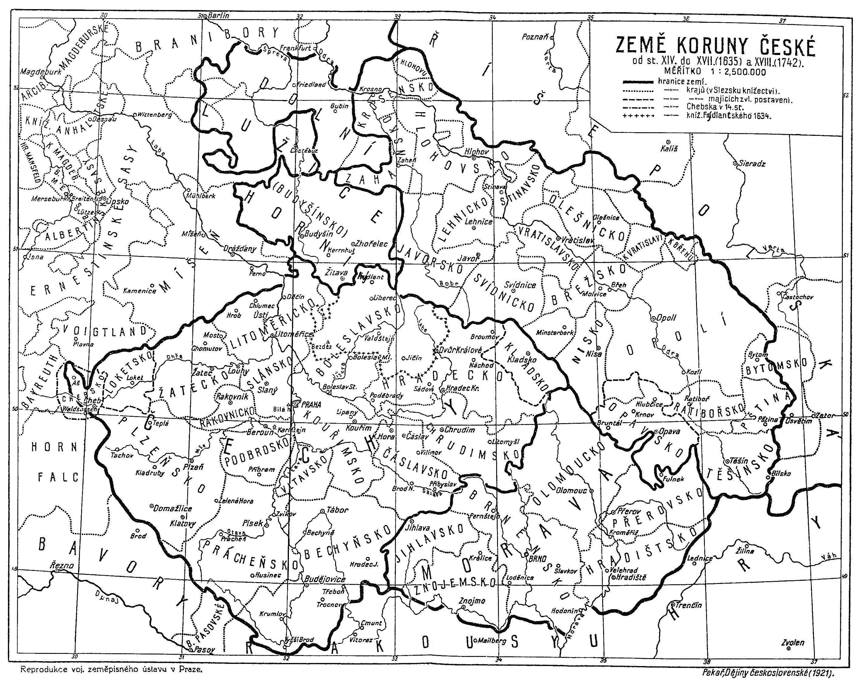
| Opis | Map of the Lands of the Bohemian Crown from the 14th century until the year 1742. The descriptions are in Czech. |
| Data | |
| Źródło | Book Dějiny československé by Josef Pekař, 1991 reprint (ISBN 80-900354-2-6) of the original 1921 edition. |
| Autor | Nieznany |
|
Plik jest wierną reprodukcją fotograficzną dwuwymiarowego utworu, znajdującego się w domenie publicznej z następującego powodu:
Zgodnie z oficjalnym oświadczeniem Wikimedia Foundation wierne reprodukcje dwuwymiarowych utworów z domeny publicznej są w domenie publicznej, zajmowanie przeciwnego stanowiska godzi w samą ideę domeny publicznej (więcej w: Commons:When to use the PD-Art tag).
Niniejsza reprodukcja jest więc również własnością publiczną. Użytkowanie tego dzieła może być zabronione lub ograniczane przez miejscowe prawo na obszarze jego jurysdykcji; patrz: Commons:Reuse of PD-Art photographs. | ||||
Historia pliku
Kliknij na datę/czas, aby zobaczyć, jak plik wyglądał w tym czasie.
| Data i czas | Miniatura | Wymiary | Użytkownik | Opis | |
|---|---|---|---|---|---|
| aktualny | 14:01, 14 sty 2022 | | 2847 × 2260 (1,11 MB) | Jan Šlendr | Reverted to version as of 09:52, 29 March 2013 (UTC) - mistake |
| 14:01, 14 sty 2022 |  | 2847 × 2260 (1,89 MB) | Jan Šlendr | moravsko-slezská hranice | |
| 11:52, 29 mar 2013 |  | 2847 × 2260 (1,11 MB) | Fext | Fixed | |
| 16:01, 23 lip 2008 |  | 2887 × 2260 (1,19 MB) | Geographus | {{Information |Description= Map of the Lands of the Bohemian Crown from the 14th century until the year 1742. The descriptions are in Czech. |Source= Book Dějiny československé by Josef Pekař, 1991 reprint (ISBN 80-900354-2-6) of the original 1921 ed |
Lokalne wykorzystanie pliku
Następujące strony korzystają z tego pliku:
Globalne wykorzystanie pliku
Ten plik jest wykorzystywany także w innych projektach wiki:
- Wykorzystanie na ar.wikipedia.org
- Wykorzystanie na ba.wikipedia.org
- Wykorzystanie na be.wikipedia.org
- Wykorzystanie na ca.wikipedia.org
- Wykorzystanie na cs.wikipedia.org
- Wykorzystanie na de.wikipedia.org
- Wykorzystanie na el.wikipedia.org
- Wykorzystanie na en.wikipedia.org
- Wykorzystanie na eo.wikipedia.org
- Wykorzystanie na es.wikipedia.org
- Wykorzystanie na fi.wikipedia.org
- Wykorzystanie na fr.wikipedia.org
- Wykorzystanie na id.wikipedia.org
- Wykorzystanie na it.wikipedia.org
- Wykorzystanie na pt.wikipedia.org
- Wykorzystanie na ru.wikipedia.org
- Wykorzystanie na sk.wikipedia.org
- Wykorzystanie na sr.wikipedia.org
- Wykorzystanie na sv.wikipedia.org
- Wykorzystanie na uk.wikipedia.org