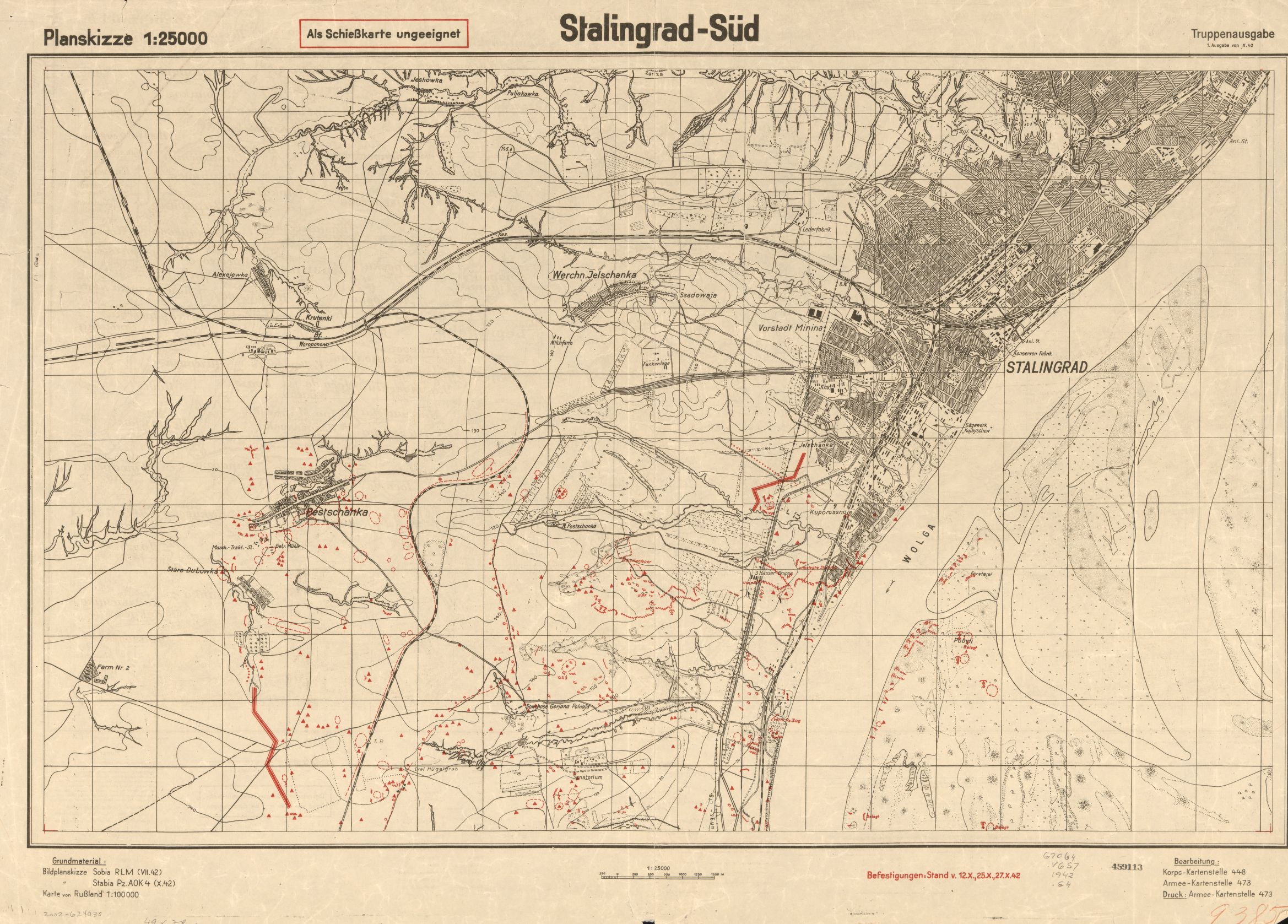
Plik:1942 German map of Stalingrad.jpg
Rozmiar podglądu – 800 × 574 pikseli. Inne rozdzielczości: 320 × 230 pikseli | 640 × 459 pikseli | 1024 × 734 pikseli | 1280 × 918 pikseli | 2338 × 1677 pikseli.
Rozmiar pierwotny (2338 × 1677 pikseli, rozmiar pliku: 891 KB, typ MIME: image/jpeg)
| Plik 1942 German map of Stalingrad.jpg znajduje się w Wikimedia Commons – repozytorium wolnych zasobów. Dane z jego strony opisu znajdują się poniżej. |
Opis
| Opis |
English: 1942 German map of Stalingrad by the German Army General Staff |
| Data | |
| Źródło |
Library of Congress Geography and Map Division Washington, D.C. 20540-4650 USA Call #: G7064.V6S7 1942 .G4 https://www.loc.gov/item/2002624030/ |
| Autor | German Generalstaff |
Licencja
| This work is from the Library of Congress. According to the library, there are no known copyright restrictions on the use of this work. |  |
This content comes from historical documents as service regulations ("Dienstvorschrift", "H.Dv.", "L.Dv", "M.Dv." etc.) or maps of the German Armed Forces (Wehrmacht) and its offices. Since these documents are considered official works, the content is in the public domain. Nevertheless, there may be restrictions on use due to other legal provisions (prohibited symbols of the Nazi era). Not all sources correctly state the rights to authorship of the Wehrmacht, sometimes it comes to the intellectual property rights fame (Copyfraud), if the authorship of the Wehrmacht and its legal successors is clearly recognizable and not indicated accordingly.
|
 |
Historia pliku
Kliknij na datę/czas, aby zobaczyć, jak plik wyglądał w tym czasie.
| Data i czas | Miniatura | Wymiary | Użytkownik | Opis | |
|---|---|---|---|---|---|
| aktualny | 13:35, 21 lip 2016 | | 2338 × 1677 (891 KB) | AugusteBlanqui | User created page with UploadWizard |
Lokalne wykorzystanie pliku
Poniższa strona korzysta z tego pliku:
Globalne wykorzystanie pliku
Ten plik jest wykorzystywany także w innych projektach wiki:
- Wykorzystanie na en.wikipedia.org