Plik:Blank Map World Secondary Political Divisions.svg

Wielkość pliku podglądu PNG dla pliku SVG: 512 × 260 pikseli Inne rozdzielczości: 320 × 163 pikseli | 640 × 325 pikseli | 1024 × 520 pikseli | 1280 × 650 pikseli | 2560 × 1300 pikseli.
Rozmiar pierwotny (Plik SVG, nominalnie 512 × 260 pikseli, rozmiar pliku: 2,38 MB)
| Plik Blank Map World Secondary Political Divisions.svg znajduje się w Wikimedia Commons – repozytorium wolnych zasobów. Dane z jego strony opisu znajdują się poniżej. |
Opis
| Opis |
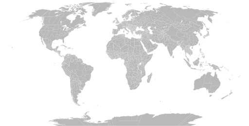
English: A detailed Robinson projection SVG map of the world with secondary political units grouped for easy coloring. |
| Data | |
| Źródło | |
| Autor |
|
Licencja
Ja, właściciel praw autorskich do tego dzieła, udostępniam je na poniższej licencji
| Ten plik udostępniony jest na licencji Creative Commons CC0 1.0 Uniwersalna Licencja Domeny Publicznej. | |
| Osoby, które współpracowały przy tworzeniu tego utworu przeniosły go do domeny publicznej poprzez zrezygnowanie ze wszystkich przysługujących im praw na obszarze całego świata z tytułu prawa autorskiego oraz wszystkich powiązanych i podobnych praw, w zakresie dopuszczalnym przez prawo. Możesz kopiować, zmieniać, rozprowadzać i wykonywać to dzieło, nawet wykorzystując do celów komercyjnych bez pytania o pozwolenie.
|
Historia pliku
Kliknij na datę/czas, aby zobaczyć, jak plik wyglądał w tym czasie.
| Data i czas | Miniatura | Wymiary | Użytkownik | Opis | |
|---|---|---|---|---|---|
| aktualny | 05:22, 28 cze 2024 | | 512 × 260 (2,38 MB) | ClaveScottPH | Fixed Greenland, some overlapping subdivisions, and others. Added subdivisions for Fiji, Malta, São Tomé and Príncipe, and Trinidad & Tobago. |
| 10:02, 25 cze 2024 |  | 512 × 260 (9,25 MB) | ClaveScottPH | Fixed. | |
| 04:08, 22 cze 2024 |  | 512 × 260 (3,45 MB) | ClaveScottPH | Fixed colors for comoros, fixed overlapping for Abkhazia, and added subdivisions for Bahrain. | |
| 16:06, 20 cze 2024 |  | 512 × 260 (2,47 MB) | ClaveScottPH | Fixed division for the Central African Republic, Montenegro, and Thailand; fixed overlapping divisions for Morocco, Nigeria, Palestine, South Ossetia (disputed), and Taiwan (disputed). | |
| 08:50, 10 cze 2024 |  | 512 × 260 (2,42 MB) | ClaveScottPH | Fixed | |
| 06:01, 10 cze 2024 |  | 3413 × 1752 (5,9 MB) | ClaveScottPH | {{subst:update-note|1=File:Blank Map World Secondary Political Divisions.svg|2=new cantons in Luxembourg, municipalities in Latvia, new regions in Chile, Tanzania, the Philippines, Mali, Kazakhstan, Ghana, and Ethiopia, new prefectures in the Central African Republic, new provinces in Equatorial Guinea, Burundi, Algeria, Laos, Indonesia, Nepal, and the Democratic Republic of the Congo, new governorates in Lebanon and Oman, new administrative area in South Sudan have been created.}} ~~~~ | |
| 21:10, 28 maj 2022 |  | 2560 × 1314 (4,59 MB) | Betseg | Reverted to version as of 00:32, 13 March 2022 (UTC). Nearly double the size because of the high detailed divisions, and the colours were broken. | |
| 23:47, 7 maj 2022 |  | 2560 × 1314 (7,27 MB) | Abbasi786786 | Made Pakistan and Nigeria more precise; Added new Congolese provinces | |
| 02:32, 13 mar 2022 |  | 2560 × 1314 (4,59 MB) | Abbasi786786 | Merged KPK and former FATA, Pakistan | |
| 13:20, 13 gru 2021 |  | 2560 × 1314 (4,59 MB) | W0nderhat | Reverted to version as of 18:26, 6 June 2020 (UTC); removal of Chilean Patagonia unnecessary and confusing, ISO codes an unfortunate casualty (will look into how to restore them) |
Lokalne wykorzystanie pliku
Żadna strona nie korzysta z tego pliku.
Globalne wykorzystanie pliku
Ten plik jest wykorzystywany także w innych projektach wiki:
- Wykorzystanie na bn.wikipedia.org
- Wykorzystanie na bs.wikipedia.org
- Wykorzystanie na en.wikipedia.org
- Government
- Administrative division
- Wikipedia:Blank maps
- Wikipedia:Graphics Lab/Map workshop/Archive/May 2011
- User:Naqsh-e hJahan/List of provinces
- User talk:Naqsh-e hJahan/List of provinces
- Wikipedia:Graphics Lab/Illustration workshop/Archive/Jun 2023
- Wikipedia:Graphics Lab/Map workshop/Archive/Jul 2023
- Wykorzystanie na ja.wikipedia.org
- Wykorzystanie na ne.wikipedia.org
- Wykorzystanie na sq.wikipedia.org
- Wykorzystanie na sr.wikipedia.org
- Wykorzystanie na te.wikipedia.org
- Wykorzystanie na tr.wikipedia.org
- Wykorzystanie na zh.wikipedia.org