Plik:Crookston Minnesota aerial view.jpg
Rozmiar podglądu – 800 × 562 pikseli. Inne rozdzielczości: 320 × 225 pikseli | 640 × 449 pikseli | 1024 × 719 pikseli | 1280 × 899 pikseli | 1500 × 1053 pikseli.
Rozmiar pierwotny (1500 × 1053 pikseli, rozmiar pliku: 820 KB, typ MIME: image/jpeg)
| Plik Crookston Minnesota aerial view.jpg znajduje się w Wikimedia Commons – repozytorium wolnych zasobów. Dane z jego strony opisu znajdują się poniżej. |
| Opis |
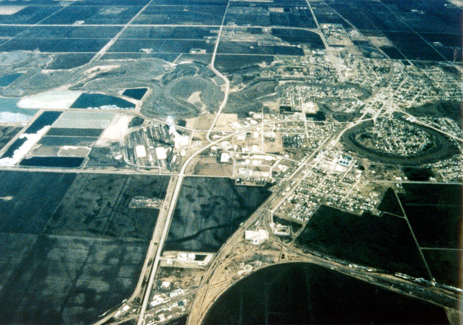
English: Aerial view of Crookston, Minnesota, USA. The Red Lake River twists and turns on its way through the city. The Red Lake River runs west-northwest to join the Red River about 22 miles (straight line) west of Crookston at Grand Forks, North Dakota (hence the name Grand Forks). |
|||
| Data | ||||
| Źródło |
U.S. Army Corps of Engineers Digital Visual Library Image page Image description page Digital Visual Library home page |
|||
| Autor | Tom Crump, U.S. Army Corps of Engineers | |||
| Licencja (Ponowne użycie tego pliku) |
|
|||
| Miejsce | Crookston, Minnesota, USA |
| Pozycja fotografa | | To i inne zdjęcia na: OpenStreetMap |
|---|
Historia pliku
Kliknij na datę/czas, aby zobaczyć, jak plik wyglądał w tym czasie.
| Data i czas | Miniatura | Wymiary | Użytkownik | Opis | |
|---|---|---|---|---|---|
| aktualny | 05:47, 7 kwi 2007 | | 1500 × 1053 (820 KB) | DanMS | {{Information | Description = {{en|Aerial view of Crookston, Minnesota, USA. The Red Lake River twists and turns on its way through the city. The Red Lake River runs west-northwest to join the Red River about 22 miles (straight line) west of Crookston |
Lokalne wykorzystanie pliku
Poniższa strona korzysta z tego pliku:
Globalne wykorzystanie pliku
Ten plik jest wykorzystywany także w innych projektach wiki:
- Wykorzystanie na de.wikipedia.org
- Wykorzystanie na en.wikipedia.org
- Wykorzystanie na he.wikipedia.org
- Wykorzystanie na it.wikipedia.org
- Wykorzystanie na nn.wikipedia.org