Plik:Germany (2), Neuwerk, Scharhörn, Nigehörn.jpg
Rozmiar podglądu – 691 × 600 pikseli. Inne rozdzielczości: 277 × 240 pikseli | 553 × 480 pikseli | 885 × 768 pikseli | 1180 × 1024 pikseli | 1941 × 1684 pikseli.
Rozmiar pierwotny (1941 × 1684 pikseli, rozmiar pliku: 550 KB, typ MIME: image/jpeg)
| Plik Germany (2), Neuwerk, Scharhörn, Nigehörn.jpg znajduje się w Wikimedia Commons – repozytorium wolnych zasobów. Dane z jego strony opisu znajdują się poniżej. |
,_Neuwerk,_Scharh%C3%B6rn,_Nigeh%C3%B6rn.jpg)
Opis
| Opis |
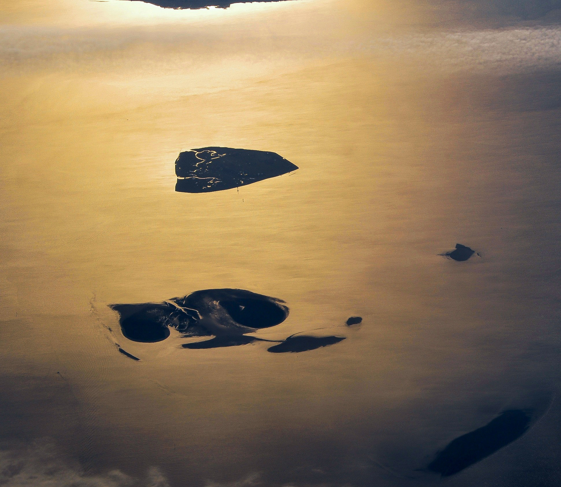
English: Aerial picture of the Hamburg Wadden Sea National Park (German: Nationalpark Hamburgisches Wattenmeer). This park is an exclave of the city state of Hamburg and lies 12.5 km off Cuxhaven in the estuary of the Elbe in the North Sea. The park includes the islands of Neuwerk (above), Scharhörn and Nigehörn (below, appearing as a single island in this picture taken at low tide). The two other islands (right and below right) are parts of the Scharhörn and Neuwerk mudflats (Scharhörner und Neuwerker Watt). Viewing direction is toward the SE.
Nederlands: Luchtfoto van het Hamburgse Nationale Park Waddenzee (Duits: Nationalpark Hamburgisches Wattenmeer). Dit park is een exclave van de stadstaat Hamburg en ligt 12.5 ten NW van Cuxhaven in de monding van de Elbe in de Noordzee. Het park omvat de eilanden Neuwerk (boven), Scharhörn en Nigehörn (die op de foto op één eiland lijken). De twee andere eilanden (rechts en rechts onder) zijn delen van het Scharhörnse en Neuwerkse Wad (Scharhörner und Neuwerker Watt). Blikrichting is naar het zuidoosten. |
| Data | |
| Źródło | Praca własna |
| Autor | Vincent van Zeijst |
| Licencja (Ponowne użycie tego pliku) |
Ten plik udostępniony jest na licencji Creative Commons Uznanie autorstwa – Na tych samych warunkach 3.0.
|
| Pozycja fotografa | | To i inne zdjęcia na: OpenStreetMap |
|---|
,_Neuwerk,_Scharh%C3%B6rn,_Nigeh%C3%B6rn.jpg¶ms=053.998083_N_0008.338622_E_globe:Earth_type:camera_region:DE_heading:135.00&language=pl)
| Adnotacje | To zdjęcie jest opatrzone adnotacją: Zobacz adnotacje w Commons |
Historia pliku
Kliknij na datę/czas, aby zobaczyć, jak plik wyglądał w tym czasie.
| Data i czas | Miniatura | Wymiary | Użytkownik | Opis | |
|---|---|---|---|---|---|
| aktualny | 15:59, 27 gru 2017 | | 1941 × 1684 (550 KB) | Aeroid | dust removal |
| 18:59, 26 mar 2011 |  | 1941 × 1684 (543 KB) | Loranchet | {{Information |Description ={{en|1=Aerial picture of the Hamburg Wadden Sea National Park (German: Nationalpark Hamburgisches Wattenmeer). This park is an exclave of the city state of Hamburg and lies 12.5 km off Cuxhaven in the estuary of the Elbe in |
Lokalne wykorzystanie pliku
Poniższa strona korzysta z tego pliku:
Globalne wykorzystanie pliku
Ten plik jest wykorzystywany także w innych projektach wiki:
- Wykorzystanie na az.wikipedia.org
- Wykorzystanie na ban.wikipedia.org
- Wykorzystanie na de.wikipedia.org
- Wykorzystanie na en.wikipedia.org
- Wykorzystanie na fa.wikipedia.org
- Wykorzystanie na hsb.wikipedia.org
- Wykorzystanie na mk.wikipedia.org
- Wykorzystanie na nl.wikipedia.org
- Wykorzystanie na sv.wikipedia.org
- Wykorzystanie na tr.wikipedia.org
- Wykorzystanie na ur.wikipedia.org
- Wykorzystanie na vi.wikipedia.org
- Wykorzystanie na zh.wikipedia.org
,_Neuwerk,_Scharhörn,_Nigehörn.jpg)