Plik:Grolla - Map of Groenlo, after 1628 (J.Blaeu, 1649).jpg
Rozmiar podglądu – 783 × 599 pikseli. Inne rozdzielczości: 314 × 240 pikseli | 627 × 480 pikseli | 1003 × 768 pikseli | 1280 × 980 pikseli | 2560 × 1960 pikseli | 5500 × 4211 pikseli.
Rozmiar pierwotny (5500 × 4211 pikseli, rozmiar pliku: 2,7 MB, typ MIME: image/jpeg)
| Plik Grolla - Map of Groenlo, after 1628 (J.Blaeu, 1649).jpg znajduje się w Wikimedia Commons – repozytorium wolnych zasobów. Dane z jego strony opisu znajdują się poniżej. |
.jpg)
Opis
| Opis |
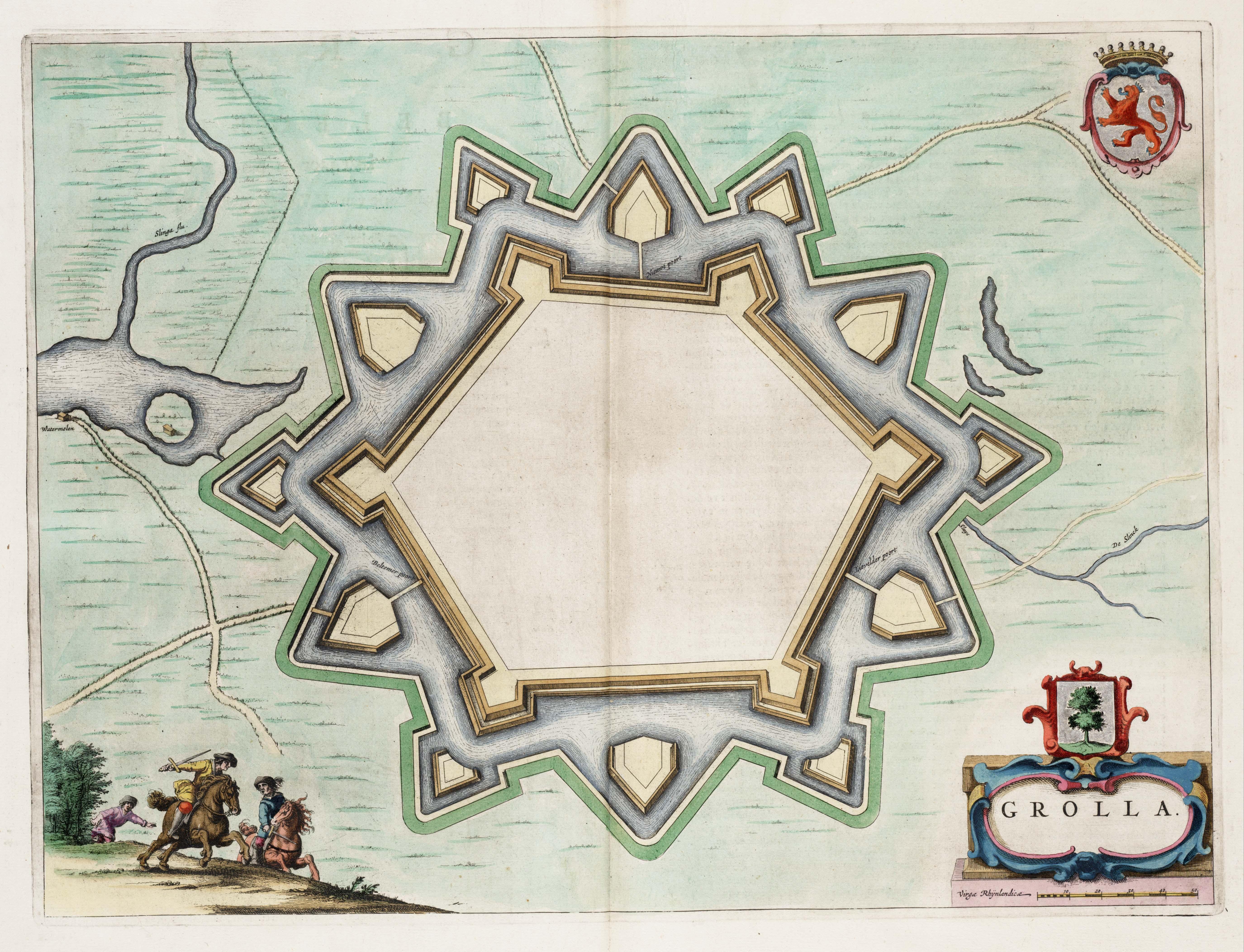
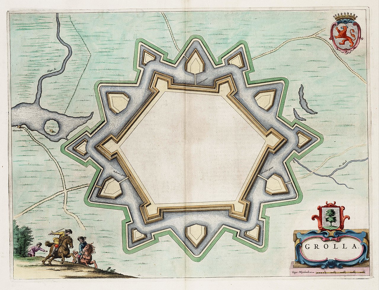
English: Map of the defensive works of Grolla (Groenlo) - the Netherlands, after the restaurations made in 1628. Map found in the Theater of Cities of 1649.
Nederlands: Kaart van de wallen in Grolle (Groenlo), na de herstelwerkzaamheden van 1628. Kaart uit het Toonneel der Steeden van 1649. |
| Data | |
| Źródło | Toonneel der Steeden van de vereenighde Nederlanden |
| Autor | J.Blaeu |
| Licencja (Ponowne użycie tego pliku) |
Public Domain |
Licencja
|
Ten materiał przeszedł do domeny publicznej w kraju pochodzenia, jak również w państwach i terytoriach, gdzie prawo autorskie wygasa w ciągu 100 lat po śmierci autora. | |
| Plik rozpoznano jako wolny od znanych ograniczeń praw autorskich, włącznie z prawami zależnymi i pokrewnymi. | |
Historia pliku
Kliknij na datę/czas, aby zobaczyć, jak plik wyglądał w tym czasie.
| Data i czas | Miniatura | Wymiary | Użytkownik | Opis | |
|---|---|---|---|---|---|
| aktualny | 03:51, 8 wrz 2008 | | 5500 × 4211 (2,7 MB) | Kweniston | {{Information |Description={{en|1=Map of the defensive works of Grolla (Groenlo), after the restaurations made in 1628. Map found in the ''Theater of Cities'' of 1649.}} {{nl|1=Kaart van de wallen in Grolle (Groenlo), na de herstelwerkzaamheden van 1628. |
Lokalne wykorzystanie pliku
Poniższa strona korzysta z tego pliku:
Globalne wykorzystanie pliku
Ten plik jest wykorzystywany także w innych projektach wiki:
- Wykorzystanie na en.wikipedia.org
- Wykorzystanie na fr.wikipedia.org
- Wykorzystanie na ja.wikipedia.org
- Wykorzystanie na nl.wikipedia.org
- Wykorzystanie na ru.wikipedia.org
- Wykorzystanie na www.wikidata.org
.jpg)