Plik:Haitian Port Damage1.jpg
Rozmiar podglądu – 800 × 534 pikseli. Inne rozdzielczości: 320 × 213 pikseli | 640 × 427 pikseli | 1018 × 679 pikseli.
Rozmiar pierwotny (1018 × 679 pikseli, rozmiar pliku: 123 KB, typ MIME: image/jpeg)
| Plik Haitian Port Damage1.jpg znajduje się w Wikimedia Commons – repozytorium wolnych zasobów. Dane z jego strony opisu znajdują się poniżej. |
Opis
| Opis |
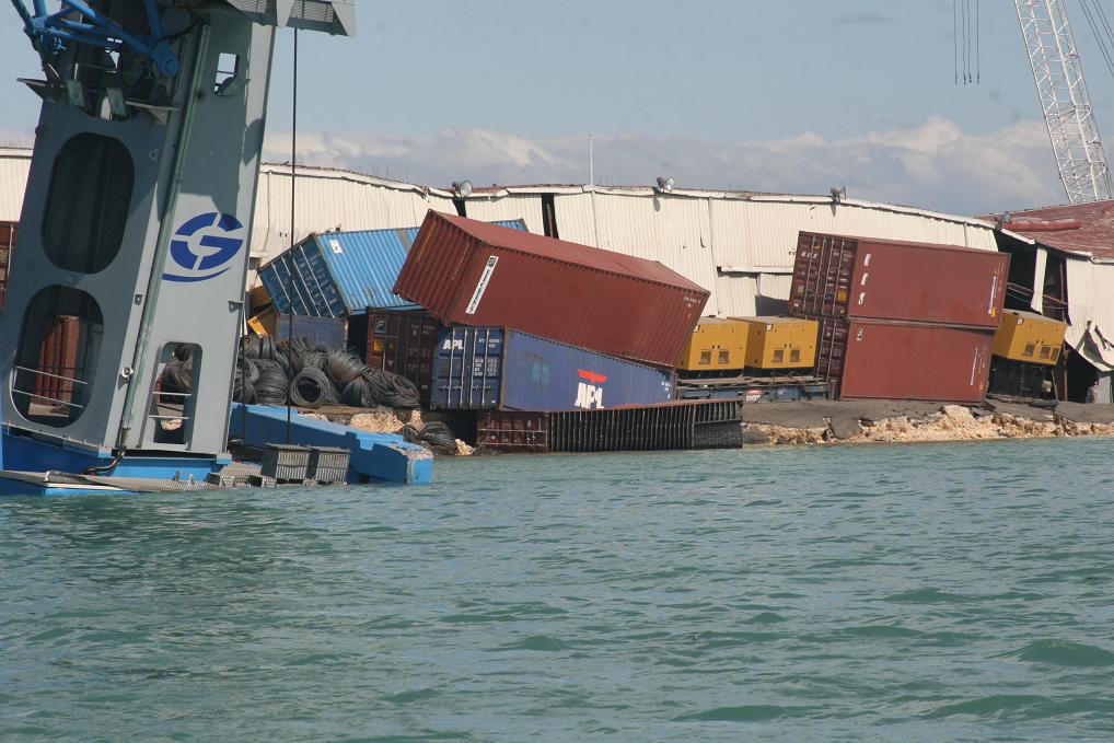
English: PORT-AU-PRINCE, Haiti – "Coast Guard crewmembers photographed tumbling shipping containers at Port-au-Prince Jan. 13, 2010. Coast Guard personnel arrived in Haiti to assess damage to the ports and waterways after an earthquake ravaged the island Jan. 12, 2010. U.S. Coast Guard photo." (Text From U.S. Coast Guard) |
| Data | |
| Źródło | U.S. Coast Guard, 100113-G-9999G-050-Damaged Haiti Ports |
| Autor | U.S. Coast Guard photo |
| Pozycja fotografa | | To i inne zdjęcia na: OpenStreetMap |
|---|
Licencja
This image or file is a work of a United States Coast Guard service personnel or employee, taken or made as part of that person's official duties. As a work of the U.S. federal government, the image or file is in the public domain (17 U.S.C. § 101 and § 105, USCG main privacy policy and specific privacy policy for its imagery server).
|
 |
Historia pliku
Kliknij na datę/czas, aby zobaczyć, jak plik wyglądał w tym czasie.
| Data i czas | Miniatura | Wymiary | Użytkownik | Opis | |
|---|---|---|---|---|---|
| aktualny | 04:25, 14 sty 2010 | | 1018 × 679 (123 KB) | Marcusmax | {{Information |Description={{en|1=PORT-AU-PRINCE, Haiti -- "Coast Guard crewmembers photographed tumbling shipping containers at Port-au-Prince Jan. 13, 2010. Coast Guard personnel arrived in Haiti to assess damage to the ports and waterways after an eart |
Lokalne wykorzystanie pliku
Poniższa strona korzysta z tego pliku:
Globalne wykorzystanie pliku
Ten plik jest wykorzystywany także w innych projektach wiki:
- Wykorzystanie na ast.wikipedia.org
- Wykorzystanie na de.wikipedia.org
- Wykorzystanie na en.wikinews.org
- Wykorzystanie na eo.wikipedia.org
- Wykorzystanie na es.wikipedia.org
- Wykorzystanie na fi.wikipedia.org
- Wykorzystanie na fr.wikipedia.org
- Wykorzystanie na hr.wikipedia.org
- Wykorzystanie na ja.wikipedia.org
- Wykorzystanie na ms.wikipedia.org
- Wykorzystanie na ru.wikipedia.org
- Wykorzystanie na sh.wikipedia.org
- Wykorzystanie na szl.wikipedia.org
- Wykorzystanie na tr.wikipedia.org
- Wykorzystanie na uk.wikipedia.org
- Wykorzystanie na www.wikidata.org