Plik:Lancashire UK location map.svg

Wielkość pliku podglądu PNG dla pliku SVG: 513 × 600 pikseli Inne rozdzielczości: 205 × 240 pikseli | 410 × 480 pikseli | 657 × 768 pikseli | 876 × 1024 pikseli | 1751 × 2048 pikseli | 1116 × 1305 pikseli.
Rozmiar pierwotny (Plik SVG, nominalnie 1116 × 1305 pikseli, rozmiar pliku: 2,3 MB)
| Plik Lancashire UK location map.svg znajduje się w Wikimedia Commons – repozytorium wolnych zasobów. Dane z jego strony opisu znajdują się poniżej. |
| Opis |
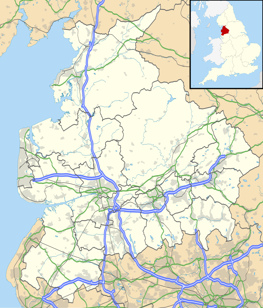
Map of Lancashire, UK with the following information shown:
Equirectangular map projection on WGS 84 datum, with N/S stretched 165% Geographic limits:
|
| Data | |
| Źródło |
|
| Autor | Nilfanion, created using Ordnance Survey data |
| Licencja (Ponowne użycie tego pliku) |
Ten plik udostępniony jest na licencji Creative Commons Uznanie autorstwa – Na tych samych warunkach 3.0. Uznanie autorstwa: Contains Ordnance Survey data © Crown copyright and database right
|
| Inne wersje | File:Lancashire UK district map (blank).svg - Blank map |
.svg)
Historia pliku
Kliknij na datę/czas, aby zobaczyć, jak plik wyglądał w tym czasie.
| Data i czas | Miniatura | Wymiary | Użytkownik | Opis | |
|---|---|---|---|---|---|
| aktualny | 20:59, 26 wrz 2010 | | 1116 × 1305 (2,3 MB) | Nilfanion | {{Information |Description=Map of Lancashire, UK with the following information shown: *Administrative borders *Coastline, lakes and rivers *Roads and railways *Urban areas Equirectangular map projection on WGS 84 datum, with N/S stretch |
Lokalne wykorzystanie pliku
Z tego pliku korzysta więcej niż 100 stron. Poniższa lista pokazuje jedynie 100 pierwszych z nich. Dostępna jest również pełna lista.
- Abbey Village
- Abbeystead
- Accrington
- Acre (Lancashire)
- Adlington
- Aldcliffe
- Altham
- Anderton (Lancashire)
- Andertons Mill
- Appley Bridge
- Arkholme-with-Cawood
- Astley Village
- Aughton (West Lancashire)
- Bacup
- Bailrigg
- Balderstone (Lancashire)
- Balladen
- Bamber Bridge
- Bank Fold
- Bank Houses
- Banks (Lancashire)
- Barnoldswick
- Barrow Nook
- Baxenden
- Bay Horse
- Beardwood
- Belmont (Lancashire)
- Belthorn
- Bent Gate
- Bickerstaffe
- Billington (Lancashire)
- Bilsborrow
- Bispham (Blackpool)
- Bispham Green
- Blackamoor
- Blackburn
- Blackburn (stacja kolejowa)
- Blackpool
- Blackpool North
- Blackpool South
- Bleasdale
- Bloomfield Road
- Bolton-by-Bowland
- Bolton-le-Sands
- Bolton Green
- Bonds
- Borwick
- Bowgreave
- Bracewell and Brogden
- Bretherton
- Brindle
- Brinscall
- Brockhall Village
- Broughton (Lancashire)
- Buckshaw Village
- Burnley
- Burscough
- Cabus
- Cadshaw
- Calder Vale
- Cantsfield
- Carleton (Lancashire)
- Carnforth
- Catforth
- Caton-with-Littledale
- Chapeltown (Lancashire)
- Chorley
- Clayton-le-Moors
- Cleveleys
- Clitheroe
- Colne (Lancashire)
- Darwen
- Deepdale
- Ewood Park
- Fleetwood
- Garstang
- Great Harwood
- Haslingden
- Kirkham (Lancashire)
- Lancashire
- Lancaster
- Lancaster (stacja kolejowa)
- Leyland (Lancashire)
- Longridge
- Lytham St Anne’s
- Medlar-with-Wesham
- Morecambe
- Ormskirk
- Oswaldtwistle
- Padiham
- Penwortham
- Port lotniczy Blackpool
- Poulton-le-Fylde
- Preston
- Preston (stacja kolejowa)
- Ramsbottom
- Rawtenstall
- Rishton
- Skelmersdale
- Standish (Wielki Manchester)
Pokaż więcej odnośników do tego pliku.
Globalne wykorzystanie pliku
Ten plik jest wykorzystywany także w innych projektach wiki:
- Wykorzystanie na ar.wikipedia.org
- Wykorzystanie na bg.wikipedia.org
- Wykorzystanie na ceb.wikipedia.org
- Wykorzystanie na en.wikipedia.org
- Accrington
- Bacup
- Lancaster, Lancashire
- Preston, Lancashire
- Chorley
- Astley Hall, Chorley
- Blackpool
- Read, Lancashire
- Ormskirk
- Bury, Greater Manchester
- Burnley
- Galgate
- Heysham
- Blackburn
- Barnoldswick
- Darwen
- Clitheroe
- Parbold
- Adlington, Lancashire
- Kirkham, Lancashire
- Lytham St Annes
- Longridge
- Poulton-le-Fylde
- Carnforth
- Reedley Hallows
- Up Holland
- Padiham
- Clayton-le-Moors
- Brierfield, Lancashire
- Oswaldtwistle
- Fleetwood
- Whalley, Lancashire
- Cleveleys
- Centre points of the United Kingdom
- Stonyhurst
- Bolton-le-Sands
- Haslingden
- River Wyre
- Lancashire Infantry Museum
- Higham, Lancashire
- Nelson, Lancashire
- Colne
- Wycoller
- Bleasdale
- Scarisbrick
- Knott End-on-Sea
- Great Altcar
Pokaż listę globalnego wykorzystania tego pliku.