Plik:QuebecSatelliteNASA.jpg
Grafika w wyższej rozdzielczości nie jest dostępna.
QuebecSatelliteNASA.jpg (800 × 481 pikseli, rozmiar pliku: 183 KB, typ MIME: image/jpeg)
| Plik QuebecSatelliteNASA.jpg znajduje się w Wikimedia Commons – repozytorium wolnych zasobów. Dane z jego strony opisu znajdują się poniżej. |
Opis
| Opis |
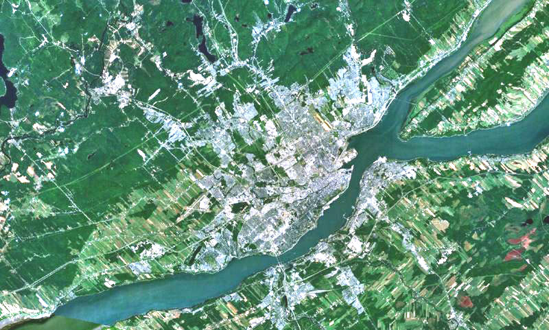
English: Quebec city on the north shore of St. Lawrence river, Lévis on the south shore and Orleans Island in the river.
Français : La ville de Québec sur la rive nord du fleuve Saint-Laurent, Lévis sur la rive-sud et l'île d'Orléans dans le fleuve. |
| Data | 8 grudnia 2005 (first upload on Commons) |
| Źródło | File:Quebec city-satellite image.jpg |
| Autor | NASA |
| Inne wersje |
|

Licencja
| This image is in the public domain because it is a screenshot from NASA’s globe software World Wind using a public domain layer, such as Blue Marble, MODIS, Landsat, SRTM, USGS or GLOBE.
|
 |
Historia pliku
Kliknij na datę/czas, aby zobaczyć, jak plik wyglądał w tym czasie.
| Data i czas | Miniatura | Wymiary | Użytkownik | Opis | |
|---|---|---|---|---|---|
| aktualny | 06:52, 5 wrz 2007 | | 800 × 481 (183 KB) | Gilbertus | {{Information |Description=English: Quebec city on the north shore of St. Lawrence river, Lévis on the south shore and Orleans Island in the river. Français : La ville de Québec sur la rive nord du fleuve Saint-Laurent, Lévis sur la rive-sud et l'île |
Lokalne wykorzystanie pliku
Poniższa strona korzysta z tego pliku:
Globalne wykorzystanie pliku
Ten plik jest wykorzystywany także w innych projektach wiki:
- Wykorzystanie na ar.wikipedia.org
- Wykorzystanie na en.wikipedia.org
- Wykorzystanie na es.wikipedia.org
- Wykorzystanie na fr.wikipedia.org
- Wykorzystanie na www.wikidata.org