Plik:Road junction in Barrowford, Lancashire - geograph.org.uk - 776422.jpg
Grafika w wyższej rozdzielczości nie jest dostępna.
Road_junction_in_Barrowford,_Lancashire_-_geograph.org.uk_-_776422.jpg (640 × 410 pikseli, rozmiar pliku: 107 KB, typ MIME: image/jpeg)
| Plik Road junction in Barrowford, Lancashire - geograph.org.uk - 776422.jpg znajduje się w Wikimedia Commons – repozytorium wolnych zasobów. Dane z jego strony opisu znajdują się poniżej. |
Opis
| Opis |
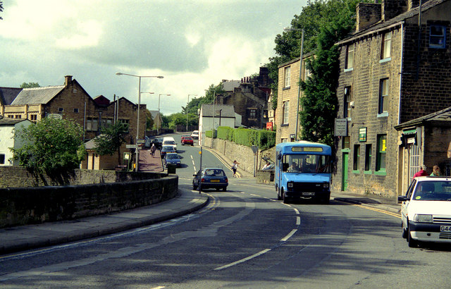
English: Road junction in Barrowford, Lancashire, near to Barrowford, Lancashire, Great Britain.
This shows the junction of Gisburn Road (main road, part of the A682) with Church Street (in the centre). The latter road gives access to the Pendleside villages such as Fence, Wheatley Lane and Higham, while the A682 gives a route from the A56 in Barrowford to the A59 at Gisburn. The blue minibus displays route number 66, destination: Blacko, a village about two miles away up the A682. |
| Data | |
| Źródło | From geograph.org.uk; transferred by User:Skinsmoke using geograph_org2commons. |
| Autor | Dr Neil Clifton |
| Licencja (Ponowne użycie tego pliku) |
Creative Commons Attribution Share-alike license 2.0 |
| Uznanie autorstwa (wymagana przez licencję) | Dr Neil Clifton / Road junction in Barrowford, Lancashire / |
| Pozycja fotografa | | To i inne zdjęcia na: OpenStreetMap |
|---|
| Pozycja obiektu | | To i inne zdjęcia na: OpenStreetMap |
|---|
_region:GB-GBN_heading:202.00&language=pl)
Licencja

|
Ta grafika pochodzi z kolekcji projektu Geograph. Aby zobaczyć szczegóły możesz odwiedzić stronę tego zdjęcia w serwisie Geograph. Prawa autorskie do tej grafiki posiada Dr Neil Clifton i jest ona udostępniona na licencji Creative Commons Uznanie autorstwa – Na tych samych warunkach 2.0.
|
Ten plik udostępniony jest na licencji Creative Commons Uznanie autorstwa – Na tych samych warunkach 2.0.
Uznanie autorstwa: Dr Neil Clifton
- Wolno:
- dzielić się – kopiować, rozpowszechniać, odtwarzać i wykonywać utwór
- modyfikować – tworzyć utwory zależne
- Na następujących warunkach:
- uznanie autorstwa – musisz określić autorstwo utworu, podać link do licencji, a także wskazać czy utwór został zmieniony. Możesz to zrobić w każdy rozsądny sposób, o ile nie będzie to sugerować, że licencjodawca popiera Ciebie lub Twoje użycie utworu.
- na tych samych warunkach – Jeśli zmienia się lub przekształca niniejszy utwór, lub tworzy inny na jego podstawie, można rozpowszechniać powstały w ten sposób nowy utwór tylko na podstawie tej samej lub podobnej licencji.
Historia pliku
Kliknij na datę/czas, aby zobaczyć, jak plik wyglądał w tym czasie.
| Data i czas | Miniatura | Wymiary | Użytkownik | Opis | |
|---|---|---|---|---|---|
| aktualny | 23:45, 27 lip 2010 | | 640 × 410 (107 KB) | File Upload Bot (Magnus Manske) | == {{int:filedesc}} == {{Information |Description={{en|1=Road junction in Barrowford, Lancashire, near to Barrowford, Lancashire, Great Britain. This shows the junction of Gisburn Road (main road, part of the A682) with Church Street (in the centre). The |
Lokalne wykorzystanie pliku
Poniższa strona korzysta z tego pliku:
Globalne wykorzystanie pliku
Ten plik jest wykorzystywany także w innych projektach wiki:
- Wykorzystanie na ceb.wikipedia.org
- Wykorzystanie na en.wikipedia.org
- Wykorzystanie na en.wikivoyage.org
- Wykorzystanie na es.wikipedia.org
- Wykorzystanie na it.wikipedia.org
- Wykorzystanie na lld.wikipedia.org
- Wykorzystanie na www.wikidata.org