Plik:Thatched Cottage and Maypole - geograph.org.uk - 314401.jpg
Grafika w wyższej rozdzielczości nie jest dostępna.
Thatched_Cottage_and_Maypole_-_geograph.org.uk_-_314401.jpg (640 × 480 pikseli, rozmiar pliku: 124 KB, typ MIME: image/jpeg)
| Plik Thatched Cottage and Maypole - geograph.org.uk - 314401.jpg znajduje się w Wikimedia Commons – repozytorium wolnych zasobów. Dane z jego strony opisu znajdują się poniżej. |
Opis
| Opis |
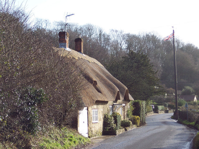
English: Thatched Cottage and Maypole Ansty is a very picturesque village with a large pond surrounded by the Manor House, cottages and ancient Commandery.
It has been the scene of May Day gatherings for over 1,000 years. The Maypole itself was a gift from the Arundells of Wardour Castle and replaced every twenty years - the present one is keeping with earlier tradition, still has a silver coin lodged beneath the weather vane. It is said that whoever is brave enough or foolhardy enough to climb the pole can keep it. Originally, tenants of the Wardour estate brought their children to meet each other and dance around the maypole every year. This gathering has continued annually for hundreds of years, except during 1644 to 1660 when Puritan officials removed the pole by government statute. |
| Data | |
| Źródło | From geograph.org.uk |
| Autor | Trish Steel |
| Pozycja fotografa | | To i inne zdjęcia na: OpenStreetMap |
|---|
_heading:135.00&language=pl)
| Pozycja obiektu | | To i inne zdjęcia na: OpenStreetMap |
|---|
_heading:135.00&language=pl)
Licencja

|
Ta grafika pochodzi z kolekcji projektu Geograph. Aby zobaczyć szczegóły możesz odwiedzić stronę tego zdjęcia w serwisie Geograph. Prawa autorskie do tej grafiki posiada Trish Steel i jest ona udostępniona na licencji Creative Commons Uznanie autorstwa – Na tych samych warunkach 2.0.
|
Ten plik udostępniony jest na licencji Creative Commons Uznanie autorstwa – Na tych samych warunkach 2.0.
Uznanie autorstwa: Trish Steel
- Wolno:
- dzielić się – kopiować, rozpowszechniać, odtwarzać i wykonywać utwór
- modyfikować – tworzyć utwory zależne
- Na następujących warunkach:
- uznanie autorstwa – musisz określić autorstwo utworu, podać link do licencji, a także wskazać czy utwór został zmieniony. Możesz to zrobić w każdy rozsądny sposób, o ile nie będzie to sugerować, że licencjodawca popiera Ciebie lub Twoje użycie utworu.
- na tych samych warunkach – Jeśli zmienia się lub przekształca niniejszy utwór, lub tworzy inny na jego podstawie, można rozpowszechniać powstały w ten sposób nowy utwór tylko na podstawie tej samej lub podobnej licencji.
Historia pliku
Kliknij na datę/czas, aby zobaczyć, jak plik wyglądał w tym czasie.
| Data i czas | Miniatura | Wymiary | Użytkownik | Opis | |
|---|---|---|---|---|---|
| aktualny | 17:53, 30 gru 2010 | | 640 × 480 (124 KB) | GeographBot | == {{int:filedesc}} == {{Information |description={{en|1=Thatched Cottage and Maypole Ansty is a very picturesque village with a large pond surrounded by the Manor House, cottages and ancient Commandery. It has been the scene of May Day gatherings for |
Lokalne wykorzystanie pliku
Poniższa strona korzysta z tego pliku:
Globalne wykorzystanie pliku
Ten plik jest wykorzystywany także w innych projektach wiki:
- Wykorzystanie na ceb.wikipedia.org
- Wykorzystanie na en.wikipedia.org
- Wykorzystanie na fr.wikipedia.org
- Wykorzystanie na lld.wikipedia.org
- Wykorzystanie na tr.wikipedia.org
- Wykorzystanie na www.wikidata.org
- Wykorzystanie na zh-min-nan.wikipedia.org