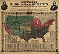
Plik:Reynolds's Political Map of the United States 1856.jpg

Rozmiar podglądu – 661 × 600 pikseli. Inne rozdzielczości: 265 × 240 pikseli | 529 × 480 pikseli | 846 × 768 pikseli | 1128 × 1024 pikseli | 2257 × 2048 pikseli | 7813 × 7090 pikseli.
Rozmiar pierwotny (7813 × 7090 pikseli, rozmiar pliku: 19,76 MB, typ MIME: image/jpeg)
Historia pliku
Kliknij na datę/czas, aby zobaczyć, jak plik wyglądał w tym czasie.
| Data i czas | Miniatura | Wymiary | Użytkownik | Opis | |
|---|---|---|---|---|---|
| aktualny | 20:29, 16 sie 2023 |  | 7813 × 7090 (19,76 MB) | Jengod | Autotune so brighter and easier to read |
| 09:28, 22 kwi 2016 |  | 7813 × 7090 (35,27 MB) | Khamar | Original improved in Adobe Photoshop by removing white strip through center where left and right sides of map join, removing some dark and white stripes from image, and nudging some of the text and lines back into alignment preserving as much of the ma... | |
| 03:40, 17 gru 2012 |  | 7828 × 7090 (16,56 MB) | T3hBra1nWa5her | Higher resolution version from the [http://memory.loc.gov/cgi-bin/query/h?ammem/gmd:@field(NUMBER+@band(g3701e+ct000604)) Library of Congress Geography and Map Division Washington]. | |
| 15:15, 1 sie 2008 |  | 2000 × 1736 (709 KB) | Bdamokos | {{Information |Description={{en|US map 1856 shows free and slave states and populations; this is "Reynolds's Political Map of the United States" (1856) from Library of Congress collection[http://lcweb2.loc.gov/ammem/aaohtml/exhibit/aopart3b.html] [[:en |
Lokalne wykorzystanie pliku
Poniższa strona korzysta z tego pliku:
Globalne wykorzystanie pliku
Ten plik jest wykorzystywany także w innych projektach wiki:
- Wykorzystanie na ar.wikipedia.org
- Wykorzystanie na ca.wikipedia.org
- Wykorzystanie na de.wikipedia.org
- Wykorzystanie na en.wikipedia.org
- Wykorzystanie na en.wikiquote.org
- Wykorzystanie na es.wikipedia.org
- Wykorzystanie na fa.wikipedia.org
- Wykorzystanie na fi.wikipedia.org
- Wykorzystanie na fr.wikipedia.org
- Wykorzystanie na he.wikipedia.org
- Wykorzystanie na hu.wikipedia.org
- Wykorzystanie na id.wikipedia.org
- Wykorzystanie na it.wikipedia.org
- Wykorzystanie na ja.wikipedia.org
- Wykorzystanie na ko.wikipedia.org
- Wykorzystanie na no.wikipedia.org
- Wykorzystanie na pt.wikipedia.org
- Wykorzystanie na ro.wikipedia.org
- Wykorzystanie na ru.wikipedia.org
- Wykorzystanie na sh.wikipedia.org
- Wykorzystanie na simple.wikipedia.org
Pokaż listę globalnego wykorzystania tego pliku.