Plik:Vinson-Map.jpg

Rozmiar podglądu – 626 × 599 pikseli. Inne rozdzielczości: 251 × 240 pikseli | 501 × 480 pikseli | 802 × 768 pikseli | 1070 × 1024 pikseli | 2139 × 2048 pikseli | 3207 × 3070 pikseli.
Rozmiar pierwotny (3207 × 3070 pikseli, rozmiar pliku: 5,48 MB, typ MIME: image/jpeg)
| Plik Vinson-Map.jpg znajduje się w Wikimedia Commons – repozytorium wolnych zasobów. Dane z jego strony opisu znajdują się poniżej. |
| Opis |
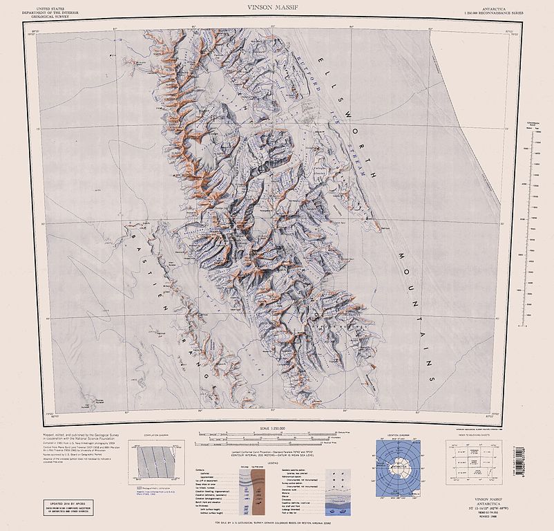
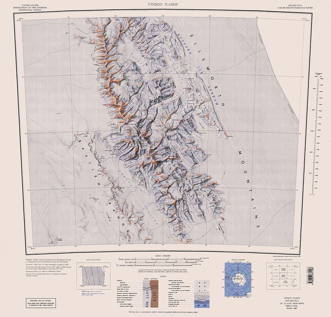
English: Map of Antarctica by the United States Antarctic Resource Center of the US Geological Survey (USGS). |
| Data | |
| Źródło | https://usarc.usgs.gov/drgs/dir1/c78082s1.jpg |
| Autor | United States Department of the Interior: Geological Survey |
| Inne wersje |
Trimmed and updated version of Wikimedia Commons Image:C78082s1_Ant.Map_Vinson_Massif.jpg. |
Ta grafika została utworzona przez pracownika Służby Geologicznej Stanów Zjednoczonych, agencji Departamentu Zasobów Wewnętrznych Stanów Zjednoczonych podczas wykonywania czynności służbowych. Jako utwór Rządu Federalnego Stanów Zjednoczonych, grafika ta znajduje się w domenie publicznej.
|
Historia pliku
Kliknij na datę/czas, aby zobaczyć, jak plik wyglądał w tym czasie.
| Data i czas | Miniatura | Wymiary | Użytkownik | Opis | |
|---|---|---|---|---|---|
| aktualny | 18:25, 22 sty 2014 | | 3207 × 3070 (5,48 MB) | Apcbg | Updated with data from SCAR Composite Gazetteer of Antarctica and other sources. |
| 09:11, 27 sie 2013 |  | 3207 × 3070 (5,47 MB) | Apcbg | Updated with data from SCAR Composite Gazetteer of Antarctica and other sources. | |
| 18:34, 9 lip 2011 |  | 3207 × 3070 (5,46 MB) | Apcbg | Updated with data from SCAR Composite Gazetteer of Antarctica and other sources. | |
| 19:34, 8 mar 2011 |  | 3207 × 3070 (5,47 MB) | Apcbg | Updated with data from SCAR Composite Gazetteer of Antarctica and other sources. | |
| 18:52, 13 paź 2010 |  | 3207 × 3070 (5,45 MB) | Apcbg | Updated with data from SCAR Composite Gazetteer of Antarctica and other sources. | |
| 12:27, 30 sty 2007 |  | 3207 × 3070 (5,4 MB) | Apcbg | Map of Antarctica by the United States Antarctic Ressource Center of the US Geological Society. Trimmed version of Wikimedia image C78082s1_Ant.Map_Vinson_Massif.jpg {{PD-US}} Copyrights and Trademarks USGS-authored or produced data and information are |
Lokalne wykorzystanie pliku
Poniższa strona korzysta z tego pliku:
Globalne wykorzystanie pliku
Ten plik jest wykorzystywany także w innych projektach wiki:
- Wykorzystanie na ar.wikipedia.org
- Wykorzystanie na ast.wikipedia.org
- Wykorzystanie na az.wikipedia.org
- Mirovyane zirvəsi
- Zimornitsa zirvəsi
- Fuça zirvəsi
- Bezden zirvəsi
- Oreşak zirvəsi
- Qolemani zirvəsi
- Marsa buzlağı
- Patleyna buzlağı
- Embree buzlağı
- Kopsis buzlağı
- Padala buzlağı
- Ellen buzlağı
- Fonfon buzlağı
- Gerila buzlağı
- Rumyana buzlağı
- Delyo buzlağı
- Burdenis buzlağı
- Arapya buzlağı
- Pulpudeva buzlağı
- Mamarçev zirvəsi
- Rutford
- Wykorzystanie na bg.wikipedia.org
- Wykorzystanie na ca.wikipedia.org
- Wykorzystanie na ceb.wikipedia.org
Pokaż listę globalnego wykorzystania tego pliku.