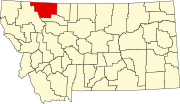
Globalne wykorzystanie „Plik:Map of Montana highlighting Glacier County.svg”
Ta strona pokazuje, gdzie plik został wykorzystany na innych wiki. Te informacje wyświetlają się również w dolnej części strony opisu pliku.

Wykorzystanie na ar.wikipedia.org
- مقاطعة غلاسير (مونتانا)
- براونينغ (مونتانا)
- كت بانك
- محمية بلاكفيت
- إيست غلاسير بارك (مونتانا)
- نورث براونينج (مونتانا)
- ساوث براونينج (مونتانا)
- قالب:مقاطعة غلاسير (مونتانا)
Wykorzystanie na bar.wikipedia.org
Wykorzystanie na bg.wikipedia.org
Wykorzystanie na bpy.wikipedia.org
Wykorzystanie na cdo.wikipedia.org
Wykorzystanie na ceb.wikipedia.org
Wykorzystanie na cy.wikipedia.org
Wykorzystanie na de.wikipedia.org
- Glacier County
- Liste der Countys in Montana
- Cut Bank
- Blackfeet Indian Reservation
- Vorlage:Navigationsleiste Orte im Glacier County
Wykorzystanie na en.wikipedia.org
- List of counties in Montana
- Glacier County, Montana
- Browning, Montana
- Cut Bank, Montana
- East Glacier Park Village, Montana
- North Browning, Montana
- South Browning, Montana
- Starr School, Montana
- Going-to-the-Sun Road
- Two Medicine Store
- St. Mary, Montana
- Rising Sun Auto Camp
- Babb, Montana
- Great Northern Railway Buildings
- Camp Disappointment
- User:Nyttend/County templates/MT
- Template:Glacier County, Montana
- Ptarmigan Tunnel
- East Glacier Ranger Station Historic District
- Two Medicine Campground Camptender's Cabin
- Cut Bank Ranger Station Historic District
- Roes Creek Campground Camptender's Cabin
- Many Glacier Campground Camptender's Cabin
- Goathaunt Bunkhouse
- Logan Pass Visitor Center
- Saint Mary Visitor Center, Entrance Station and Checking Stations
- Lee Creek Snowshoe Cabin
- Many Glacier Barn and Bunkhouse
- Kootenai Creek Snowshoe Cabin
- Swiftcurrent Auto Camp Historic District
- Swanson Boathouse