Plik:Somain - Fosse De Sessevalle, photochrome.jpg

Rozmiar pierwotny (1368 × 925 pikseli, rozmiar pliku: 1,1 MB, typ MIME: image/jpeg)
| Plik Somain - Fosse De Sessevalle, photochrome.jpg znajduje się w Wikimedia Commons – repozytorium wolnych zasobów. Dane z jego strony opisu znajdują się poniżej. |
| Opis |
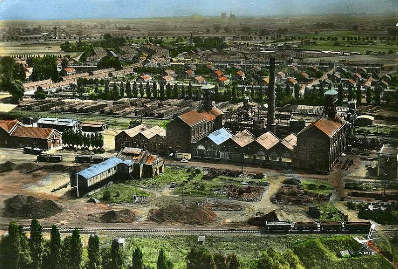
Français : Photochrome de la fosse De Sessevalle, qui était une mine souterraine de houille exploitée par la Compagnie des mines d'Aniche, puis par le Groupe de Douai au nord de Somain, près de Rieulay, dans le bassin minier du Nord-Pas-de-Calais, en France. Cette image présente une vue d'ensemble de la fosse. La présence du château d'eau indique que la photo a été prise après 1935. |
||||
| Data | między 1935 a 1940 | ||||
| Źródło | La Pie | ||||
| Autor | La Pie, image scannée et modifiée par JÄNNICK Jérémy | ||||
| Licencja (Ponowne użycie tego pliku) |
|
||||
| Inne wersje |
 |
||||
| Pozycja fotografa | | To i inne zdjęcia na: OpenStreetMap |
|---|
| Adnotacje | To zdjęcie jest opatrzone adnotacją: Zobacz adnotacje w Commons |


Historia pliku
Kliknij na datę/czas, aby zobaczyć, jak plik wyglądał w tym czasie.
| Data i czas | Miniatura | Wymiary | Użytkownik | Opis | |
|---|---|---|---|---|---|
| aktualny | 09:41, 16 wrz 2010 | | 1368 × 925 (1,1 MB) | Jérémy-Günther-Heinz Jähnick | {{Information |Description={{fr|1=Photochrome de la '''fosse De Sessevalle''', qui était une mine souterraine de houille exploitée par la [[:fr:Compagnie des mines d'Ani |
Lokalne wykorzystanie pliku
Poniższa strona korzysta z tego pliku:
Globalne wykorzystanie pliku
Ten plik jest wykorzystywany także w innych projektach wiki:
- Wykorzystanie na el.wikipedia.org
- Wykorzystanie na en.wikipedia.org
- Wykorzystanie na fr.wikipedia.org
- Wykorzystanie na gl.wikipedia.org
- Wykorzystanie na hr.wikipedia.org
- Wykorzystanie na mt.wikipedia.org
- Wykorzystanie na sh.wikipedia.org
- Wykorzystanie na tr.wikipedia.org