East Northamptonshire
East Northamptonshire – dawny dystrykt niemetropolitalny w hrabstwie Northamptonshire w Anglii, istniejący w latach 1974–2021. W 2011 roku dystrykt liczył 86 765 mieszkańców[1].
| dystrykt niemetropolitalny | |
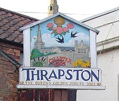
 Thrapston | |
| Państwo | |
|---|---|
| Kraj | |
| Region | |
| Hrabstwo | |
| Siedziba | |
| Powierzchnia |
509,8 km² |
| Populacja (2011) • liczba ludności |
|
| • gęstość |
170 os./km² |
Położenie na mapie Northamptonshire
| |
| Strona internetowa | |
Miasta
edytujInne miejscowości
edytujAchurch, Apethorpe, Armston, Ashton, Barnwell, Benefield, Blatherwycke, Brigstock, Bulwick, Caldecott, Chelveston, Clopton, Collyweston, Cotterstock, Deene, Deenethorpe, Denford, Easton on the Hill, Fotheringhay, Glapthorn, Great Addington, Hargrave, Harringworth, Hemington, Islip, King’s Cliffe, Laxton, Little Addington, Lower Benefield, Lowick, Luddington in the Brook, Lutton, Nassington, Newton Bromswold, Pilton, Polebrook, Ringstead, Slipton, Southwick, Stanwick, Stoke Doyle, Sudborough, Tansor, Thorpe Waterville, Thurning, Titchmarsh, Twywell, Upper Benefield, Wadenhoe, Wakerley, Warmington, Wigsthorpe, Woodford, Woodnewton, Woodwell, Yarwell.
Przypisy
edytuj- ↑ Area: East Northamptonshire (Local Authority). Neighbourhood Statistics (ONS). [dostęp 2016-04-29]. [zarchiwizowane z tego adresu (2016-10-06)]. (ang.).